Awareness Programmes
blinking red light alert

WARNING

2024-05-05

blinking red light alert

ADVISORY

2024-05-05

Weather Forecasts

  1. Public Weather
  2. Marine Weather
  3. City Forecasts
  4. 9 Day Weather Forcast
  5. Weekly Weather
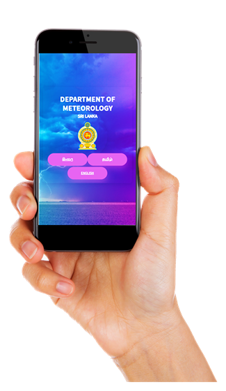
  6. Anawaki Mobile App (Android)
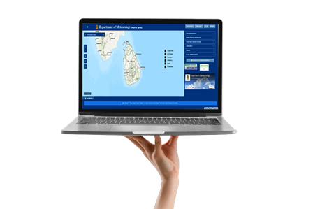
  7. GIS Weather portal

WEATHER FORECAST FOR 06 May 2024

Issued at 12.00 noon on 05 May 2024


Showers or thundershowers will occur at several places in Western, Sabaragamuwa and Central provinces and in Galle and Matara districts after 2.00 p.m.

Showers or thundershowers may occur at a few places in North-western province during the afternoon or night.

A few showers may occur over the coastal areas of Puttalam to Galle via Colombo during the morning too.

Misty conditions can be expected at some places in Central and Sabaragamuwa provinces during the morning.

General public is kindly requested to take adequate precautions to minimize damages caused by temporary localized strong winds and lightning during thundershowers.

WEATHER FORECAST FOR SEA AREAS AROUND THE ISLAND DURING NEXT 24 HOURS

 Issued at 12.00 noon on 05 May 2024.


The swell waves (about 2.5 m – 3.0 m) height and wave period (about 16s-18s) may increase in the sea areas off the coast extending from Kalpitiya to Pottuvil via Colombo, Galle, and Hambantota.

Therefore, there is a possibility that near shore sea areas off the coast extending from Kalpitiya to Matara via Colombo and Galle, may experience surges due to swell waves.

Condition of Rain:
Showers or thundershowers may occur ata few places in the sea areas off the coast extending from Colombo to Matara via Galle in the evening or night.
Winds:
Winds will be southwesterly or variable and wind speed will be (20-30) kmph. Wind speed may increase up to (40-45) kmph at times in the sea areas off the coasts extending from Puttalam toKankasanthurai via Mannar and from Batticaloa to Hambanthota via Pottuvil.
State of Sea:

The sea areas off the coasts extending from Puttalam toKankasanthurai via Mannar and from Batticaloa to Hambanthota via Pottuvil can be fairly rough at times.

Increase of swell waves (about 2.5 – 3.0 m) can be expected in the sea areasoff the coast extending fromKalpitiya to Pottuvil via Colombo, Galle and Hambantota. These sea areas can be rough at times.

Temporarily strong gusty winds and very rough seas can be expected during thundershowers.

GENERAL WEATHER FORECAST FOR NEXT 36 HOURS

Issued at 04.00 p.m. on 05 May 2024


Showers or thundershowers will occur at several places in Western, Sabaragamuwa and Central provinces and in Galle and Matara districts after 2.00 p.m.

Showers or thundershowers may occur at a few places in North-western province during the afternoon or night.

A few showers may occur over the coastal areas of Puttalam to Galle via Colombo during the morning too.

Misty conditions can be expected at some places in Central and Sabaragamuwa provinces during the morning.

General public is kindly requested to take adequate precautions to minimize damages caused by temporary localized strong winds and lightning during thundershowers.


   Weather Forecast for Main Cities                                                            Date : 6-May-2024
City Temperature (0C) Relative Humidity (%) Weather
Max Min Max Min
Anuradhapura 37 27 90 50 Mainly fair
Batticaloa 33 27 90 70 Mainly fair
Colombo 33 27 85 70 Showers or thundershowers are likely after 2.00p.m
Galle 32 28 90 75 Showers or thundershowers are likely after 2.00p.m
Jaffna 35 29 80 60 Mainly fair
Kandy 34 24 90 55 Mainly fair
Nuwara-Eliya 26 12 95 55 Mainly fair
Ratnapura 36 26 95 60 Showers or thundershowers after 2.00p.m
Trincomalee 37 27 90 55 Mainly fair
Mannar 34 28 95 70 Mainly fair


Anawaki

Play Store link - https://play.google.com/store/apps/details?id=com.weather.portal.gov


“Anawaki” is a mobile application powered by the Department of Meteorology Sri Lanka enables you make better preparation for the day in relation to giving location specific, more reliable weather forecasts and information. Check the weather forecast in your location or any location in Sri Lanka in a blink of an eye. Simply know what the weather brings and always prepare for the weather changes.


GIS Weather portal


URL: https://weather.meteo.gov.lk/


Description - The website "https://weather.meteo.gov.lk/" is a platform dedicated for providing precise and reliable weather information in Sri Lanka. It serves as an official source of meteorological data, maintained by the Meteorological department of Sri lanka. The website aims to deliver more reliable up-to-date weather forecasts, warnings and observations to the public, businesses, and different interested sectors in Sri Lanka. In addition to the basic weather data, the website also provides insights into climate patterns, seasonal variations, and other meteorological phenomena relevant to Sri Lanka. This can be particularly useful for individuals planning outdoor activities, farmers monitoring weather conditions for agricultural purposes or for businesses making decisions depending on the prevailing weather.


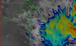
Satellite Images


Courtesy of Himawari Satellite

Last 24 hours

max temperature
Max. Temperature 37.2°C
Trincomalee/Anuradhapura
min temperature
Min. Temperature 12.5°C
Nuwara Eliya
max rain
Max. Rainfall 35.3mm
maliboda (Kegalle)

Find us on


Online Service

Providing Meteorological data and information online

(metdpa@meteo.gov.lk)

Weather and Climate Data


Tsunami Simulation Exercise

A tsunami simulation exercise was conducted in Hambantota and Batticaloa on October 14 at 6.30 in the morning in order to provide an opportunity to Indian Ocean countries to exercise their operational lines of communications, review their tsunami warnings and emergency response procedures, and to promote emergency preparedness.

This exercise was organized by the Intergovernmental Coordination Group of Indian Ocean Tsunami Warning System (ICG/IOTWS). This exercise was conducted in 15 countries in the Indian Ocean on the same day, to coincide with World Disaster Reduction Day.

In this event, the Department of Meteorology as the National Meteorological and Tsunami Early Warning Centre was issued the ‘Tsunami Watch’ and ‘Tsunami Warnings’ only to the Disaster Management Centre according to this exercise. The Disaster Management Centre was disseminated these messages to the selected communities through their early warning dissemination system.

The main purpose of Exercise tsunami incident 2009 was to test national standard operating procedures and the operational lines of communication between the National Tsunami Warning Centre and Japan Metrological Agency (JMA) and Pacific Tsunami Warning Centre in Hawaii, USA and improve coordination throughout the region.

Last Updated: 02 December 2014